Wednesday, July 30, 2025
End: Dudzic Camp
Route (km): 16.9
Total (km): 89.9
Actual (km): 21.3
Hours: 10.6
Total (hrs): 42.5
Climb up from Dried Pond
I couldn’t really tell you what it was like to climb up to the West from the pond. It wasn’t a particularly memorable part of the day. I was focused on getting up to the higher alpine zone, which wasn’t too difficult. The dried pond is already at a fairly high altitude, but there is some taller grass in the area. Climb a bit higher, and it’s all rock, which makes for good hiking.
Unremarkable Hike Past Whitford
The whole hike to get past Mt. Whitford and move through the area to the North is a bit weird, in the sense that it is not descending directly down from a ridge or climbing up to another. Instead, the route is navigating a middle area at 1400 meters altitude before climbing the hump to the North. This middle area is not too low, so bushwhacking isn’t too bad.
The Hump
The small hump South of Mt. Dudzic is the memorable part of this area for me. My progress ground to a crawl in this area, and not just because I had to climb and descend a few hundred meters. There was ample vegetation to navigate and the two successive descents were not that easy.
The Route Hits a Wall, and Goes Up It
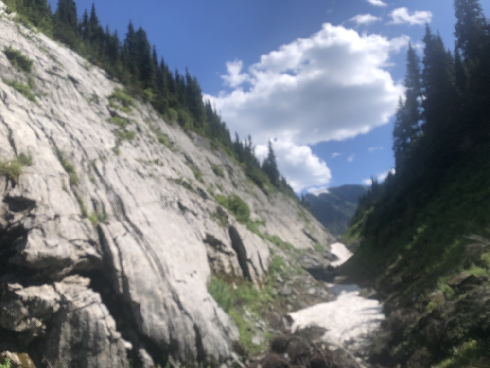
The most notable event of the day was the small ravine between the hump and Mt. Dudzic. Just getting down to the ravine demanded a bit of skill as I belayed down through a stand of trees, if my memory is correct. Once down, I breathed a sigh of relief, thinking that I would be hiking the length of the ravine.
But no! After walking the length of the ravine once or twice, I figured out that the route went right back up the opposing wall of the ravine. The problem with that is that the rock face which forms the wall is borderline dangerous. I think I may have been able to follow the route more or less, but I’m not sure.
This is the only photo I took that day. I want to clearly mark this spot as a warning for future hikers. Please consider taking the slight detour I took, in staying in the ravine, and following my path to the Southeast end, where vegetation allowed me to climb up the steep face to the North.
I’m really concerned someone could sustain a serious or even fatal injury if they fall off the tiny ledges which are the only footholds I saw on the rock wall. The climb is more than just one or two manoeuvers, it must be more than twenty meters up on the smooth rock face. Please don’t do it if you have doubts about your ability to do it safely.
Camping near Dudzic
The higher altitude hiking near Mt. Dudzic was nice. The main thing I was worried about was coming up with a campsite. The hike near Mt. Dudzic is on some steep terrain, and then as you start to leave Mt. Dudzic behind, there is one place where the terrain transitions between two slopes, and I found a decent spot to camp. It may be the only spot to camp in that area, before having to complete the rest of the ridge.
